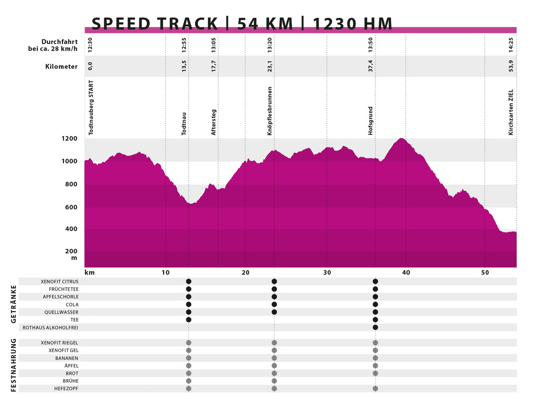
SPEED TRACK | 54 km | 1.288 elevation meters
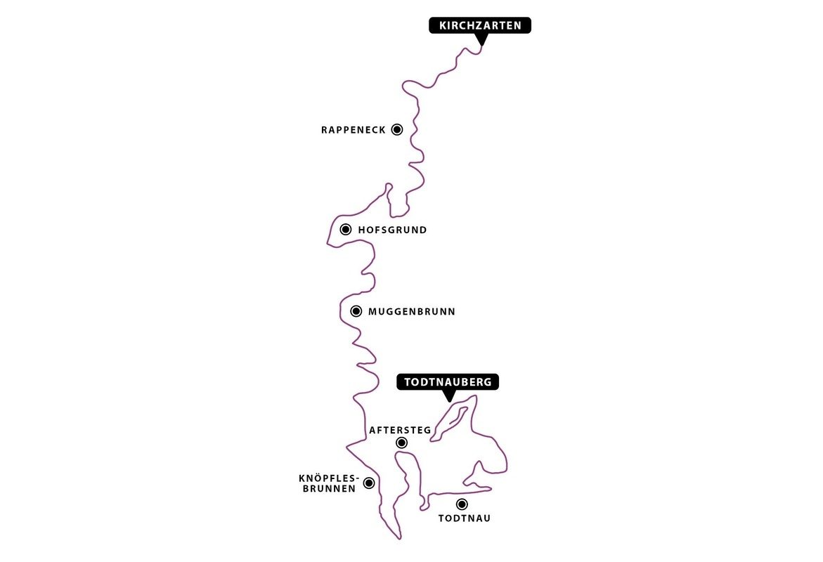
The last starting shot of the Black Forest ULTRA Bike Marathon is fired in Todtnauberg on Kurhausstraße. From here, participants of the Speed Track circle Todtnauberg once, until they reach the Berger Höhe. From there, they ride over forest paths and trails, passing by Wolfsschlucht, descending to Todtnau. In front of the mighty backdrop of St. Johannes Church in the center of Todtnau, you encounter the route of the ULTRA and find a refreshment point where you can prepare for the upcoming climb.
Back in the saddle, you head towards Todtnau-Feriendorf and continue on to Aftersteg. There, the legendary and well-deserved Alpe de Fidlebrugg finally awaits you. On the extremely challenging ascent with a 20% gradient, Thomas Zipfel and his party guests are there to cheer you up the mountain! Just when you think you've made it, there's another uphill stretch to Almgasthaus Knöpflesbrunnen, where the next refreshment point awaits.
The beautiful mountain range allows you occasional glimpses into the Wiesental until you eventually arrive in Muggenbrunn Oberhäuser. There, you have covered about half of the race distance. Through the enchanted Trubelsbach, you head towards Notschrei, to Haldenköpfle, across Schauinslandstraße to Hofsgrund. Descending on a meadow path, you reach the refreshment point at Hofsgrund Ortsmitte. Subsequently, another challenging ascent awaits you to Schauinsland, where you reach the highest point on your route at 1,239 meters above sea level.
The last 15 kilometers take you into the forest towards Rappenecker Hütte, descending to Oberried. Along the way, you encounter again the Marathon route and the Short Track. Passing through Dietenbach and the campground in Kirchzarten, you reach the finish line in the stadium.
Shuttle from Kirchzarten to Todtnauberg
You can travel to the starting point in Todtnauberg by bus from Kirchzarten. We will collect the bikes on Oberrieder Straße and securely load them onto our special transporters. Once you have handed over your bike, you can relax on the bus, ensuring that you arrive in Todtnauberg on time for the starting shot, along with your bike.
Elevation profile
Hot spots
# Todtnau
# Aftersteg / „Alpe de Fidlebrugg“
# Knöpflesbrunnen
# Haldenköpfle
# Hofsgrund
# Schauinsland
# Aftersteg / „Alpe de Fidlebrugg“
# Knöpflesbrunnen
# Haldenköpfle
# Hofsgrund
# Schauinsland
Refreshment points
| Verpflegungsstelle | UTM-Koordinaten (WGS84) | Dezimalgrad (WGS84) |
| Todtnau | 32T 421178 5298036 | 47.830841°, 7.946779° |
| Knöpflesbrunnen | 32T 418811 5297500 | 47.825727°, 7.915257° |
| Hofsgrund | 32T 417540 5305861 | 47.900773°, 7.896685° |


